
![[Angola Flag]](aoflag.gif) |
|
| AREA: | 1,246,700 sq km |
| CAPITAL: | Luanda |
| CURRENCY: | Kwanza (NKz) |
| BORDERING COUNTRIES: | Congo, Namibiam, Democratic Republic of Congo, Zambia |
| OFFICIAL LANGUAGES: | Portuguese (official), Bantu and other African languages |
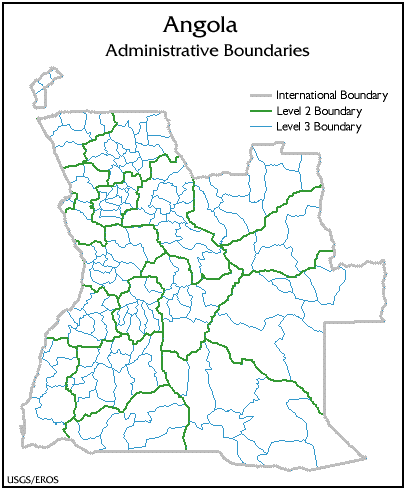
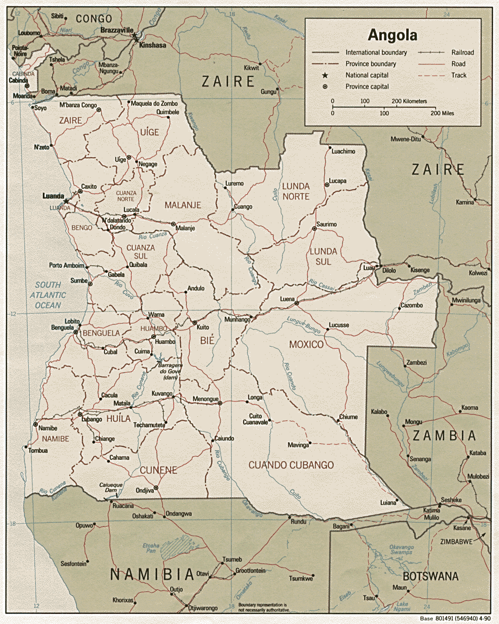 Reference map
 International Boundary
Regional Boundary
District Boundary
International Boundary
Regional Boundary
District Boundary

![[Malawi Flag]](miflag.gif) |
|
| AREA: | 118,480 sq km |
| CAPITAL: | Lilongwe |
| CURRENCY: | Malawian kwacha (MK) |
| BORDERING COUNTRIES: | Mozambique, Tanzania, Zambia |
| OFFICIAL LANGUAGES: | English (official), Chichewa (official), other languages important regionally |
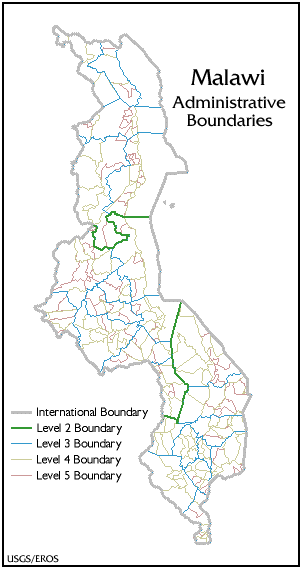
 Reference mapInternational Boundary
Regional Boundary
District Boundary
Traditional Authority Boundary
Sub-Chieftancies Boundary
Reference mapInternational Boundary
Regional Boundary
District Boundary
Traditional Authority Boundary
Sub-Chieftancies Boundary
![[Mozambique Flag]](mzflag.gif) |
|
| AREA: | 801,590 sq km |
| CAPITAL: | Maputo |
| CURRENCY: | metical (Mt) |
| BORDERING COUNTRIES: | Malawi, South Africa, Swaziland, Tanzania, Zambia, Zimbabwe |
| OFFICIAL LANGUAGES: | Portuguese (official), indigenous dialects |
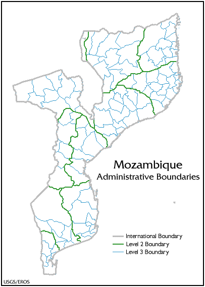
 Reference mapInternational Boundary
Province Boundary
District Boundary
Reference mapInternational Boundary
Province Boundary
District Boundary
![[Tanzania Flag]](tzflag.gif) |
|
| AREA: | 945,090 sq km |
| CAPITAL: | Dar es Salaam |
| CURRENCY: | Tanzanian shilling (TSh) |
| BORDERING COUNTRIES: | Burundi, Kenya, Malawi, Mozambique, Rwanda, Uganda, Zambia |
| OFFICIAL LANGUAGES: | Swahili (official; widely understood and generally used for communication between ethnic groups and is used in primary education), English (official; primary language of commerce, administration, and higher education) |
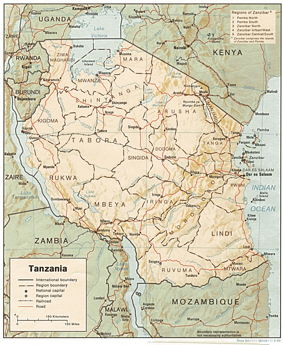 Reference mapInternational Boundary
Regional Boundary
District Boundary
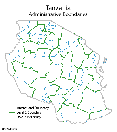
Reference mapInternational Boundary
Regional Boundary
District Boundary
![[Democratic Republic of Congo Flag]](cgflag.gif) former flag |
|
| AREA: | 2,345,410 sq km |
| CAPITAL: | Kinshasa |
| CURRENCY: | Democratic Republic of Congo (Z) |
| BORDERING COUNTRIES: | Angola, Burundi, Central African Republic, Congo, Rwanda, Sudan, Tanzania, Uganda, Zambia |
| OFFICIAL LANGUAGES: | French, Lingala, Swahili, Kingwana, Kikongo, Tshiluba |
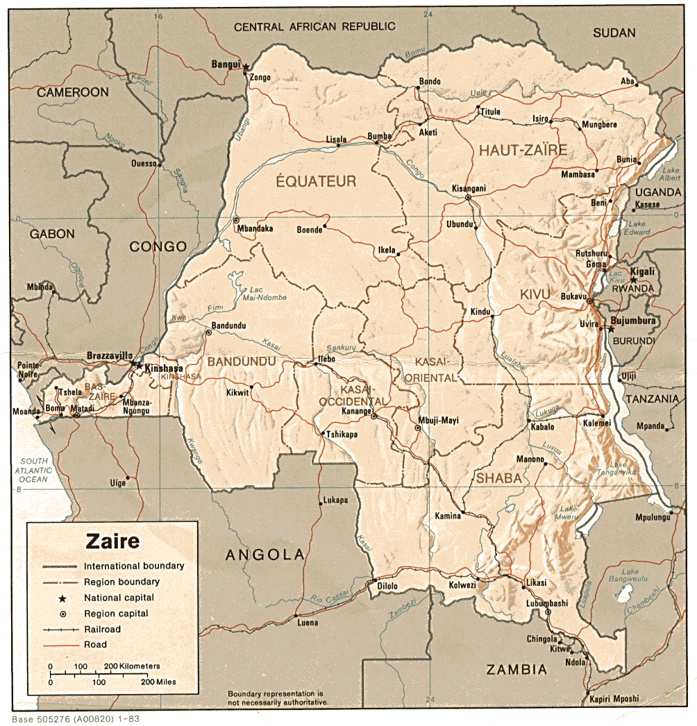 Reference mapInternational Boundary
Regional Boundary
District Boundary
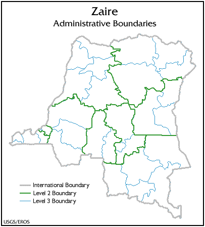
Reference mapInternational Boundary
Regional Boundary
District Boundary
![[Zambia Flag]](zaflag.gif) |
|
| AREA: | 752,610 sq km |
| CAPITAL: | Lusaka |
| CURRENCY: | Zambian kwacha (ZK) |
| BORDERING COUNTRIES: | Angola, Malawi, Mozambique, Namibia, Tanzania, Democratic Republic of Congo, Zimbabwe |
| OFFICIAL LANGUAGES: | English (official) |
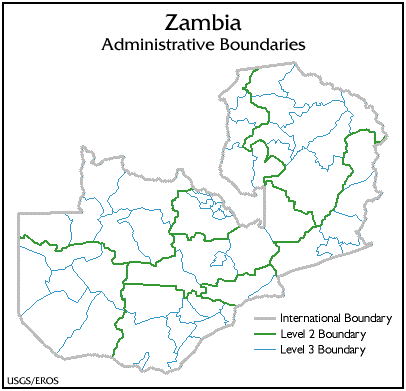
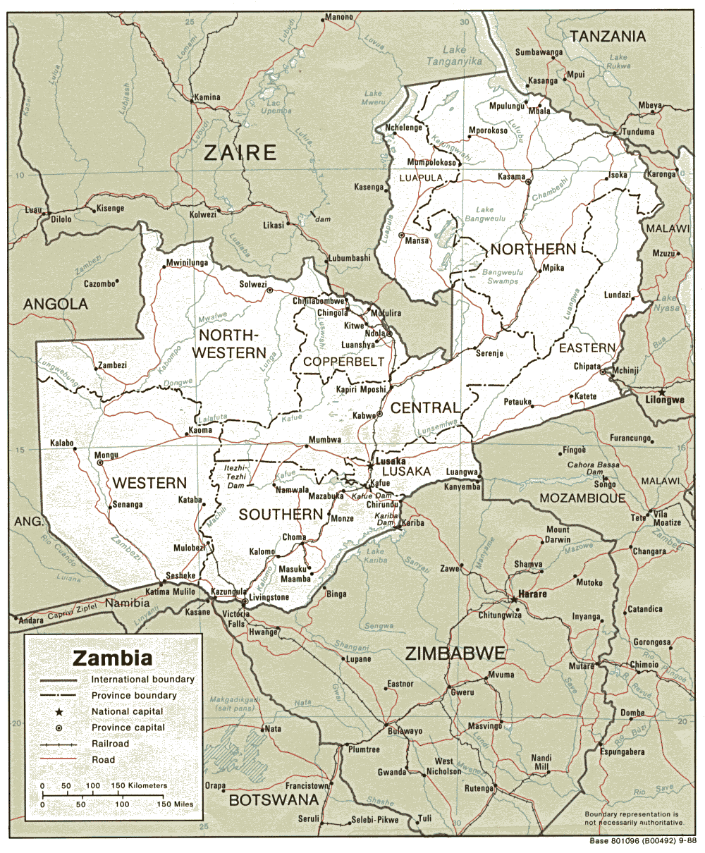 Reference mapInternational Boundary
Province Boundary
District Boundary
Reference mapInternational Boundary
Province Boundary
District Boundary
![[Zimbabwe Flag]](ziflag.gif) |
|
| AREA: | 390,580 sq km |
| CAPITAL: | Harare |
| CURRENCY: | Zimbabwean dollar (Z$) |
| BORDERING COUNTRIES: | Botswana, Mozambique, South Africa, Zambia |
| OFFICIAL LANGUAGES: | English (official), Shona, Sindebele |
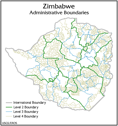
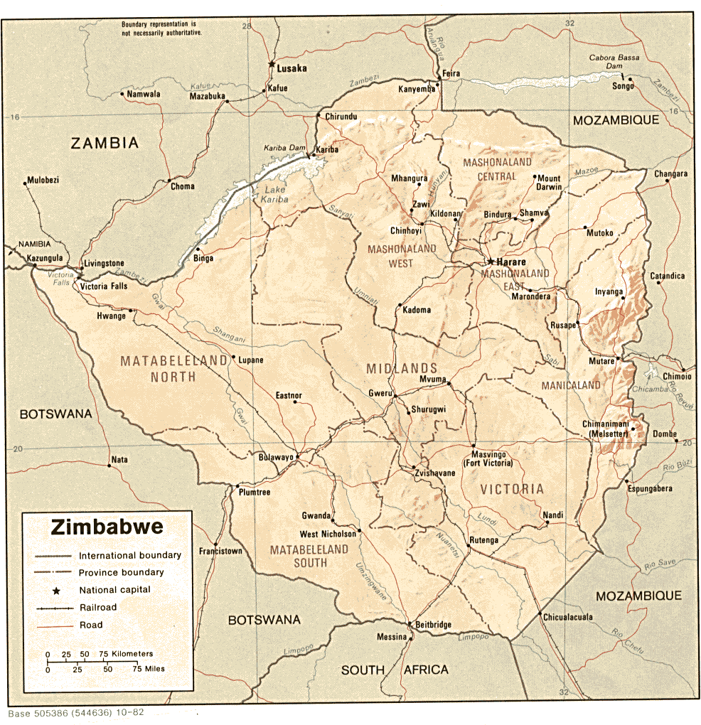 Reference mapInternational Boundary
Province Boundary
District BoundaryWard Boundary
Reference mapInternational Boundary
Province Boundary
District BoundaryWard Boundary
 http://edcintl.cr.usgs.gov/adds/adds.html