-
 Ombra: Calculation of the limit angles that cause projected shadows in a DEM
Ombra: Calculation of the limit angles that cause projected shadows in a DEM| Presentation and options | Dialog box of the application |
| Graphic examples | Syntax |
The solar azimuth is expressed in degrees from the North and clockwise (for example 134.97 is approx. SE); Astres application can give the user this information for any day in the year, at any time in any place on the Earth.
The DEM may be in byte, (short) integer (with or without sign) or real format, compressed or uncompressed.
The output file is a raster (byte, or byte-RLE when NoData zones exist) and its values are expressed in degrees, being the minimum solar elevation angle that illuminates each point when the Sun is in the direction (azimuth) given by the program. Therefore, the values in the output file will be in the interval [0,90). The palette cShadow256.dbf is especially suitable to see this output file.
If the DEM has NoData values and they are correctly documented, pixels that are affected by a NoData value in the input DEM will be treated as "transparent" in the horizon and they will be ignored in the calculations.
If the DEM is a multiband raster with pixels of different size for each band, the /MULTIBANDA parameter must be used to generate a multiband raster with the corresponding shadows models as a result. It should be noted that solar position is considered unique for all bands. If the geographical extends were excessively separated between them a unique execution for all bands with the solar position at the center of the extend ought to be done.
For the multiband case, the parameter /PREFIX= indicates the prefix added to the original file names to determine the names of the calculated files for the multiband case. By default this prefix is o_.

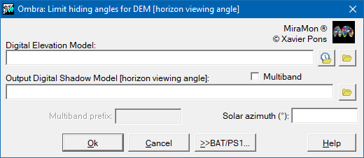 |
| Ombra dialog box |
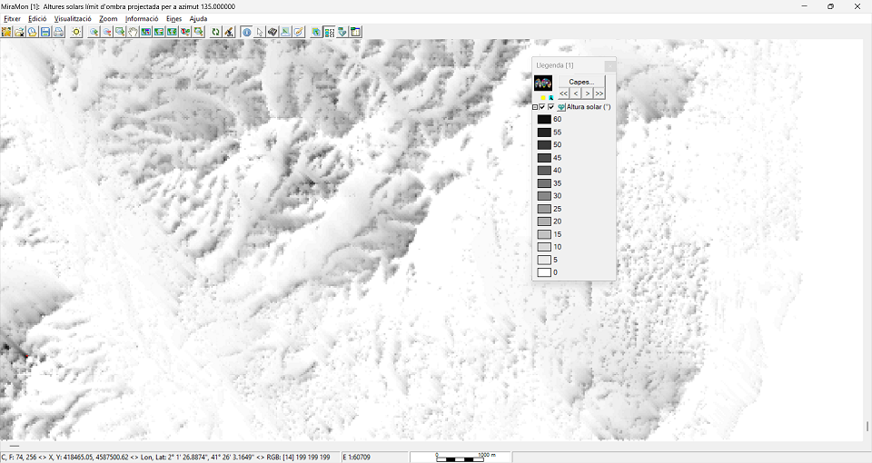 |
| Result of the calculation on an MDE with an azimuth of 135° (SE), opened with the cShad256.dbf palette, and with an image enhancement with 0% saturation in each tail of the histogram. In the SW part of the image it can be seen, marked in red, a cell that corresponds to a point where if the Sun were at the indicated azimuth it would have to be at a height >=63° to illuminate the cell with direct radiation. For solar heights <63° the point is in the shade and only receives diffuse radiation. |