-
 TassCap: Tasseled-cap transformation computation
TassCap: Tasseled-cap transformation computation| Presentation and options | Dialog box of the application |
| Syntax |
To improve crop prediction Kauth and Thomas proposed in 1976 a transformation that used the four bands of Landsat MSS in linear combinations to produce four indices known as: soil brightness index (SBI), green vegetative index (GVI), yellow stuff vegetation index (YVI) and a fourth with imprecise significance that they called "nonsuch index" (NSI). From MSS sensor (Landsat) image, they selected a set of pixel clusters identified as soil and vegetation, and they calculated by the Gram-Schmidt orthogonalization method, the eigenvalues corresponding to the coefficients of the indices.
As Principal Component Analysis (PCA), this transformation allows obtaining new bands from a linear combination of the original. However, in this case, the new bands have a precise physical meaning: the SBI inform on changes in the total reflectivity of the scene, the GVI indicate the contrast between visible and near infrared bands, closely related to vegetation activity; the YVI is related to the amount of water in vegetation and soil, so that it is usually called "wetness index". It has also called "maturity index" since its relation to the vegetation cover maturity (age, cover density, etc); finally, the NSI is sensitive to water vapor absorption, although most of its component is noise.
The application allows the following options:
For the MSS sensor exclusively, it allows to make the calculation according to the classic of Kauth and Thomas, as explained previously, as well as following:
For the rest of the Landsat series sensors, the coefficients published in the following references are used:
Huang, C., Wylie, B., Yang, L., Homer, C., Zylstram, G. (2002) Derivation of a tasselled cap transformation based on landsat-7 at satellite reflectance. International Journal of Remote Sensing, 23(8), 1741-1748. https://doi.org/10.1080/01431160110106113
Bolun Li, Chaopu Ti,Yongqiang Zhao, and Xiaoyuan Yan (2016) Estimating Soil Moisture with Landsat Data and Its Application in Extracting the Spatial Distribution of Winter Flooded Paddies Remote Sens, 8(1), 38 https://doi.org/10.3390/rs8010038
Baig, M.H.A., Zhang,L., Shuai,T., Tong, Q. (2014). Derivation of a tasselled cap transformation based on Landsat 8 at-satellite reflectance Remote Sensing Letters, 5(5):423-431. https://doi.org/10.1080/2150704X.2014.915434
Tasseled-cap has been used in a large number of applications. A drawback of this transformation is that it was computed from mid-west American crops and it is not optimized for other regions such as the Mediterranean. Another remark is that the tasseled-cap has been applied to other sensors without considering its characteristics and origins.

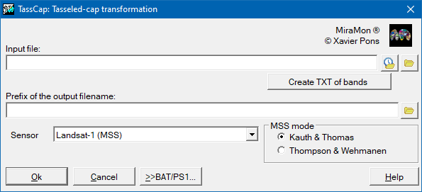 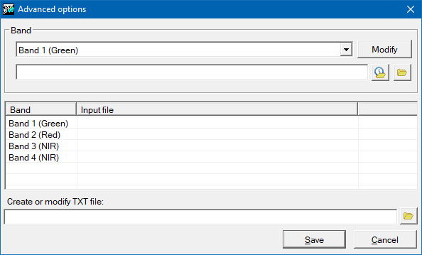 |
| Tasseled-cap transformation dialog boxes |