Favorite collections
- Fast data access through the favorite collections
- Downloadable from the input interface of the program
- Currently existing collections and, by default, in the MiraMon (any user can create their own favorite collections with maps of interest)
Collections currently existing in MiraMon:
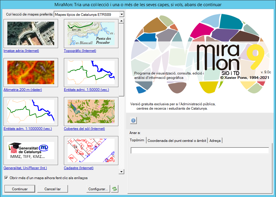
Typical maps of Catalonia + DEM 200 m (UTM-31N ETRS89, 71Mb, 25/04/2025)
Typical maps of Catalonia + DEM 30 m (UTM-31N ETRS89, 277Mb, 25/04/2025)
Contains:
|
 |
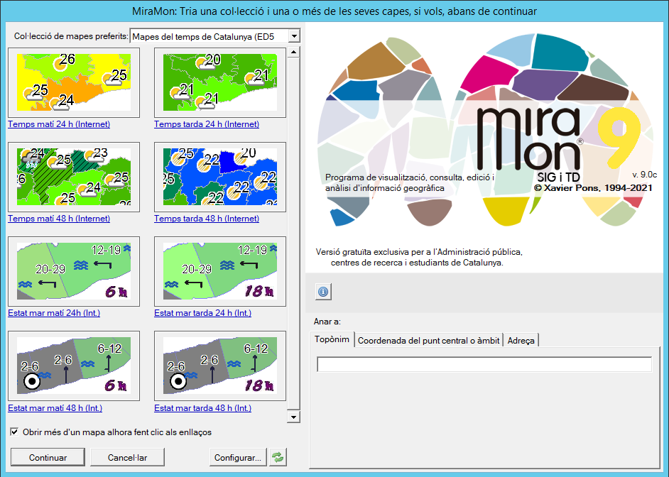
Weather maps of Catalonia (UTM-31N ETRS89, 11Mb, 28/05/2024)
Contains:
|
|
 |
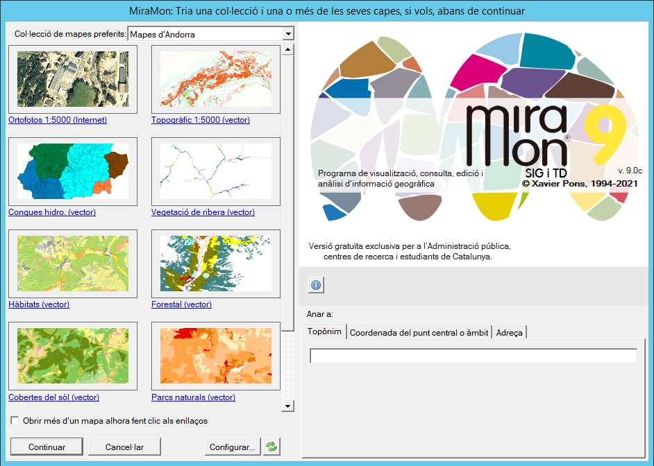
Typical maps of Andorra (LCC nova zona III NTF, 42Mb, 31/01/2025)
Typical maps of Andorra + Geomorphologic + DEM 5 m (LCC nova zona III NTF, 235Mb, 31/01/2025)
Contains:
|
 |
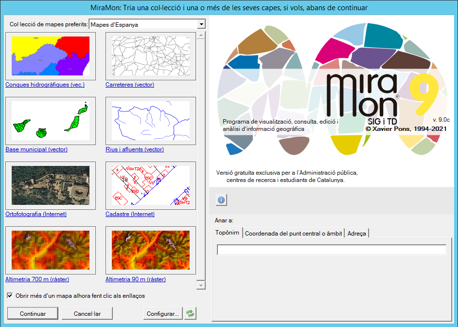
Typical maps of Spain (long-lat WGS84, 150Mb, 25/04/2025)
Typical maps of Spain + Corine Land Cover 2000 (long-lat WGS84, 394Mb, 25/04/2025)
Contains:
|
 |
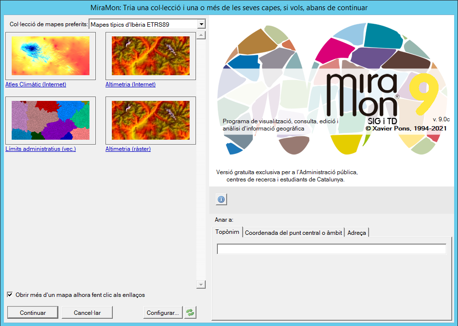
Typical maps of the Iberian Peninsula (UTM-30N ETRS89, 237Mb, 28/05/2024)
Contains:
|
 |
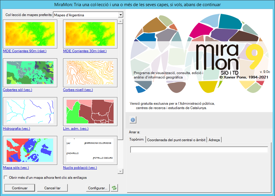
Typical maps of Argentina (Gauss-Krüger Zone 3 Argentina PosGAR98, 330Mb, 28/05/2024)
Contains:
|
 |
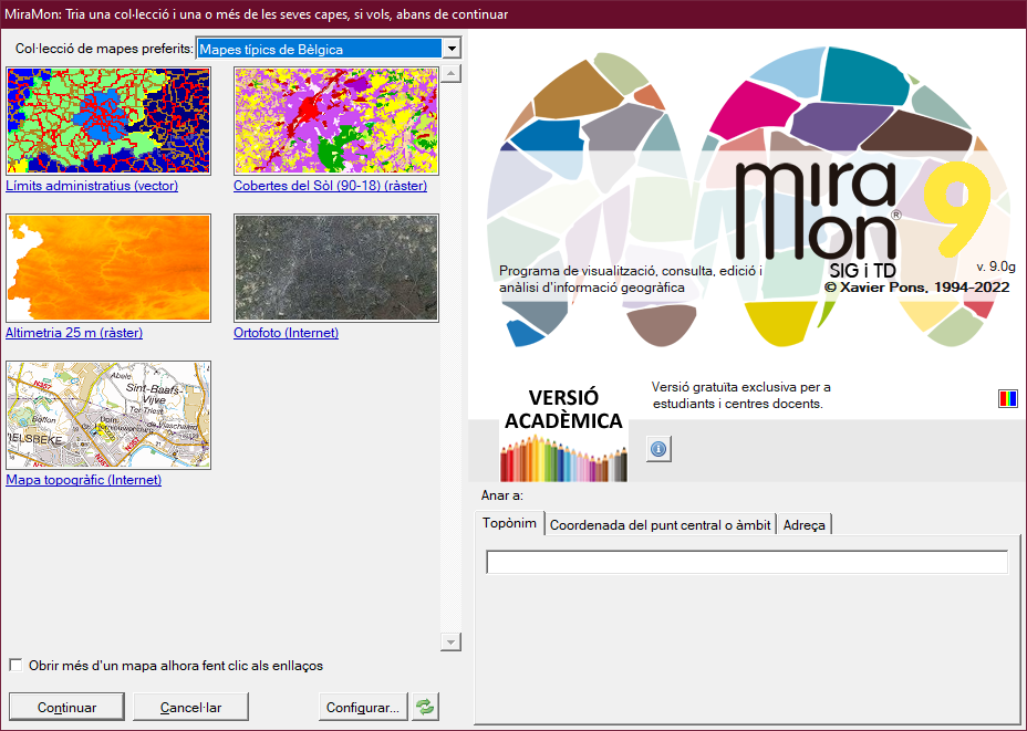
Typical maps from Belgium (Azimutal Equivalent Lambert ETRS89, 183Mb*, 28/05/2024)
Contains:
|
|
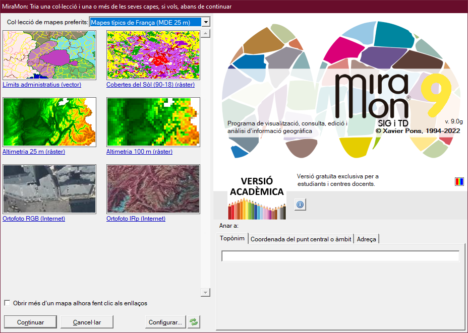
Typical maps from France (LCC ETRS89, 321Mb, 28/05/2024)
Typical maps from France + DEM 25 m (LCC ETRS89, 2272Mb*, 28/05/2024)
Contains:
|
|
Typical maps from Italy (UTM-33N WGS84, 163Mb*, 28/05/2024)
Typical maps from Italy + DEM 25 m (UTM-33N WGS84, 1841Mb*, 28/05/2024)
Contains:
|

|
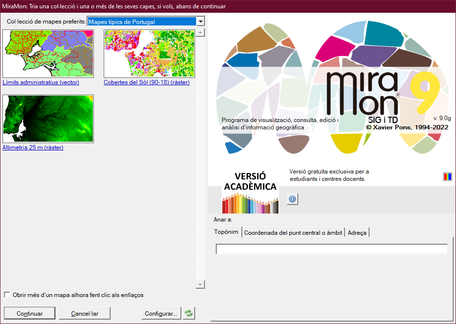
Typical maps from Portugal (Gauss-Krüger ETRS89, 521Mb*, 28/05/2024)
Contains:
|
|
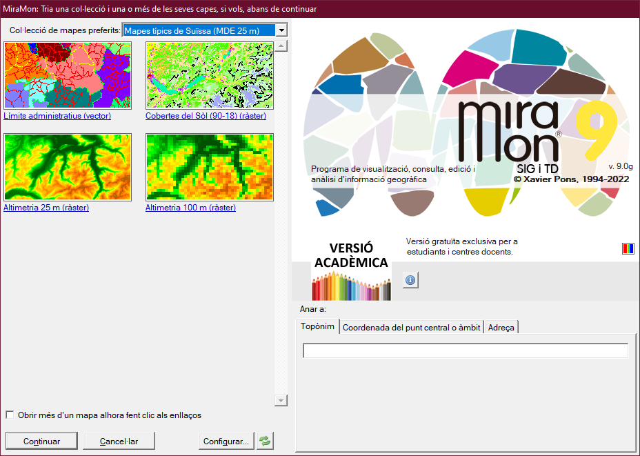
Typical maps from Switzerland (Mercator Obliqua (Rosenmund 1903), 20Mb*, 28/05/2024)
Typical maps from Switzerland + DEM 25 m (Mercator Obliqua (Rosenmund 1903), 469Mb*, 28/05/2024)
Contains:
|
|
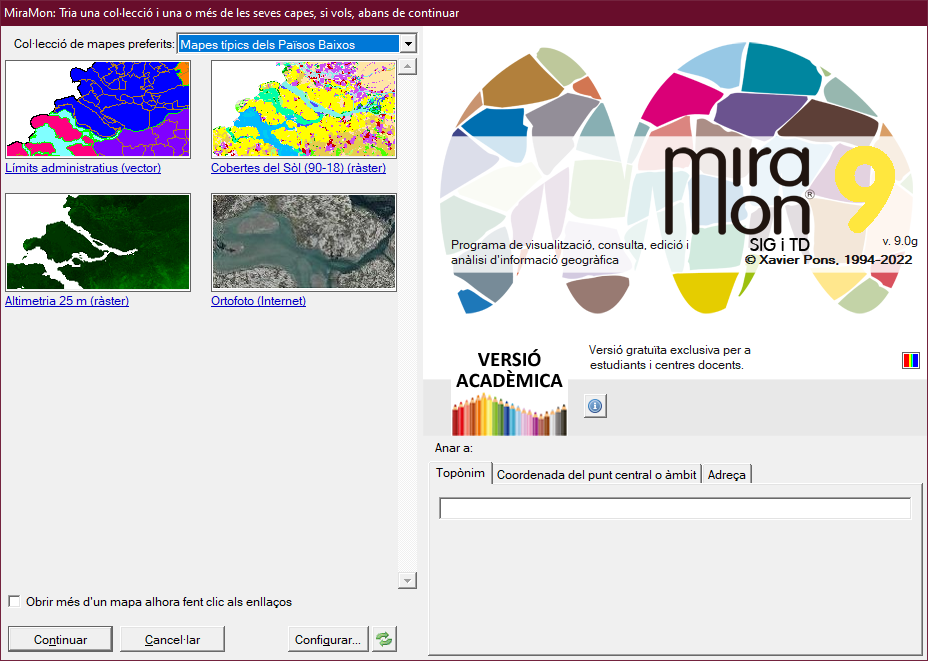
Typical maps from The Netherlands (Azimutal Equivalent Lambert ETRS89, 193Mb*, 28/05/2024)
Contains:
|
|
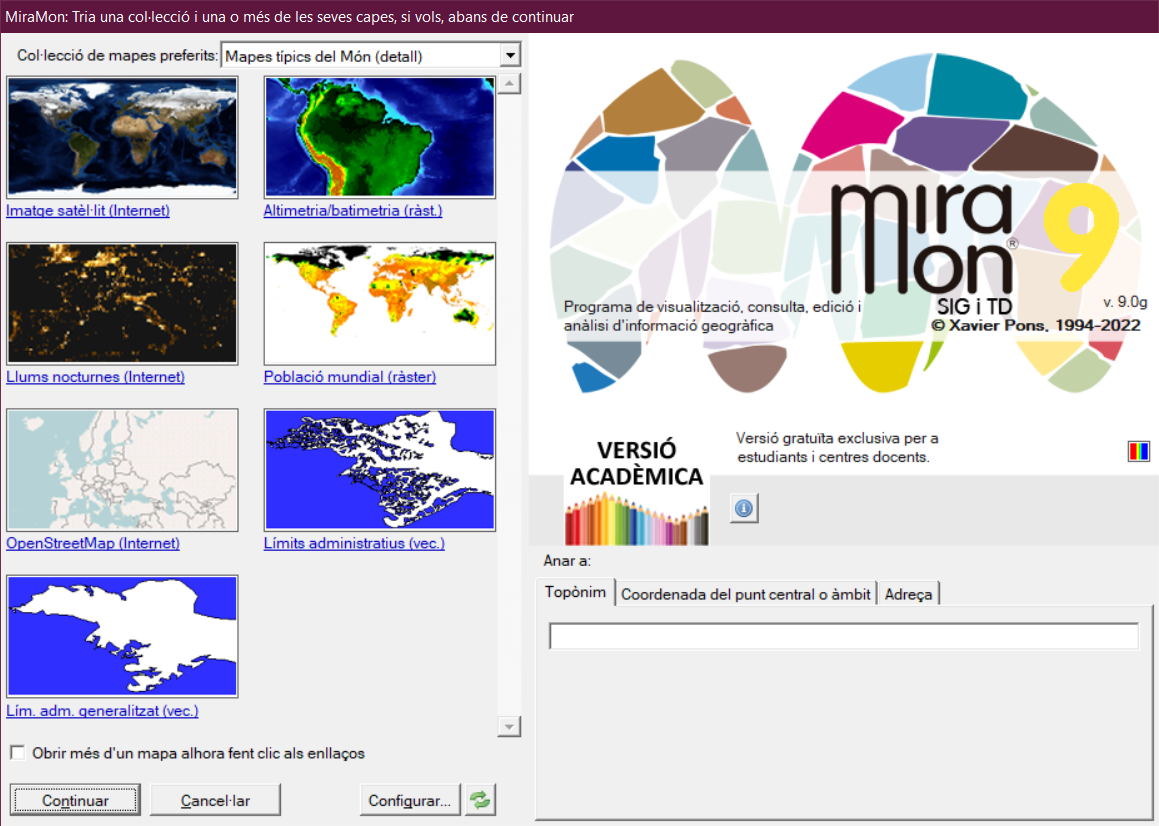
Typical maps of the World (long-lat WGS84, 256Mb*, 28/05/2024)
Typical maps of the World + detailed boundaries (long-lat WGS84, 1174Mb*, 28/05/2024)
Contains:
|
|